Late 19th - Early 20th Century Large Scale Maps
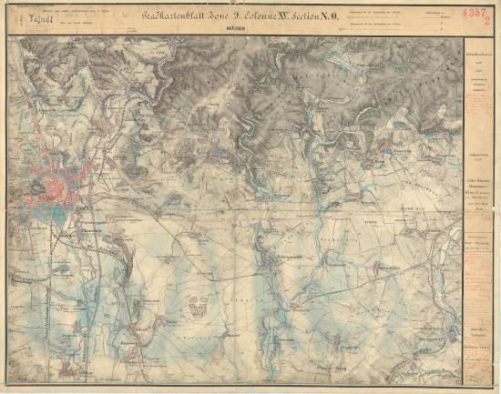
Gradkartenblatt Böhmen und Mähren
Topographic Maps of Bohemia and Moravia 1:25,000
A full color set of maps from the Third Military Survey of the Austro-Hungarian Empire, covering the majority of Bohemia and Moravia and parts of Austrian Silesia, by the K. u. K. Militärgeographisches Institut (1876-79). The set is unfortunately incomplete with the Prag section being the most obvious gap. No legend is currently available, but consulting the Legend for the Austrian Spezialkarte 1:75,000 should be helpful. Place names are variously in German and Czech, sometimes both. There is a distance measure on the upper margin of the maps. Additional cartographic information for each sheet is listed at the source library online. There are many sites of Jewish interest here.
Source: Digitalezace Univerzity Karlovy
 View full index image here
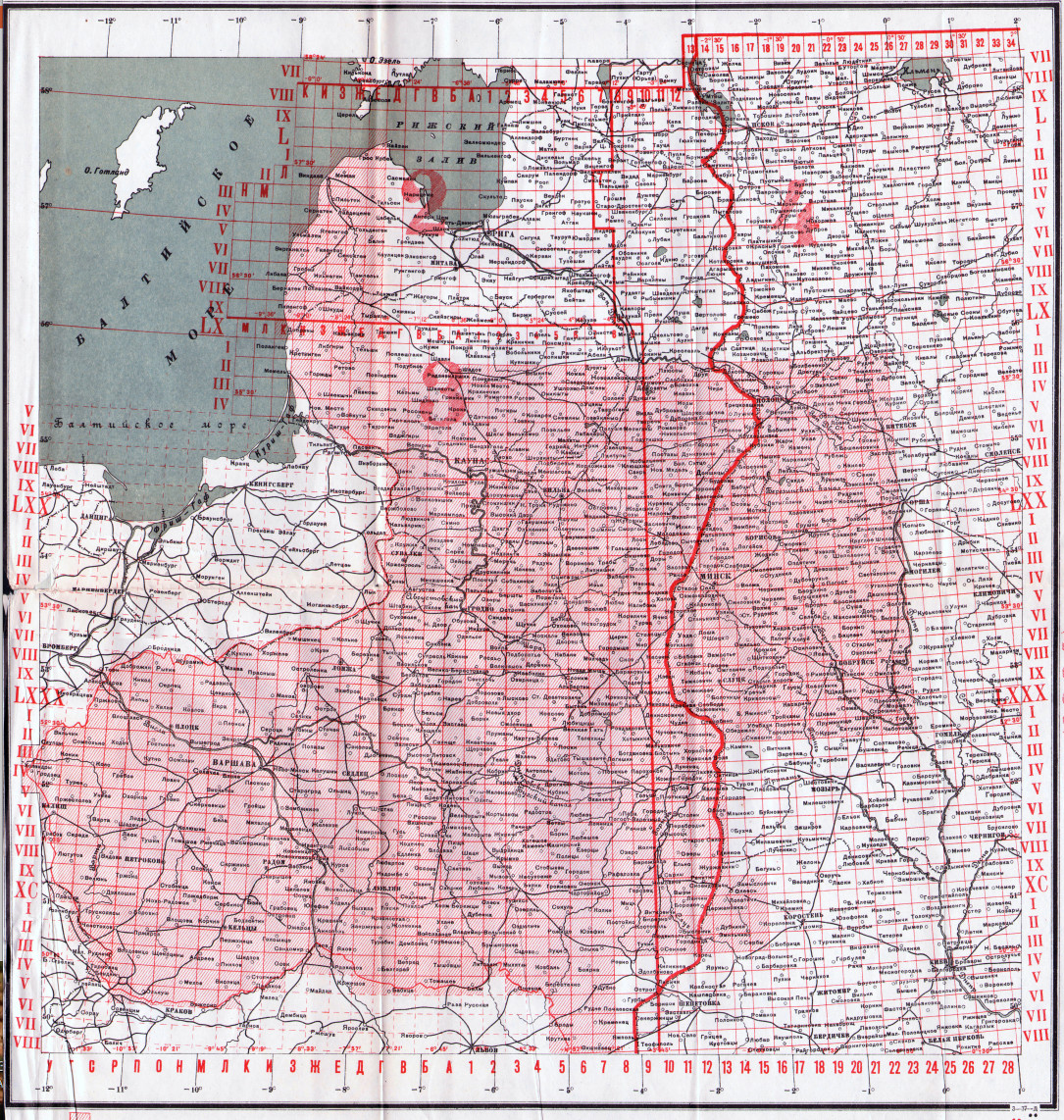
Soviet Military Topographic Maps 1:42,000
A set of maps covering part of Poland, Ukraine, and western Russia from the early Soviet period (1930's). The index image features the new eastern border (post WWI) of Poland and the Baltic States in bold red. A full historical index for this set is not available as maps extend well below the bottom of the east side of the index pictured. Thus they are offered in list form. The naming convention for maps here uses either the name of the largest settlement and/or all known places of Jewish life in the section, shown in parenthesis, making some map names lengthy.
Most, but not all sheets are re-worked from earlier editions (1890's), with color being the main addition. Originals were issued a few years before, to a few years after the turn of the 19th century, and settlements usually retain their 19th century names. Symbols and abbreviations are similar to those on the 1:84,000 Two Verst set of western Russia, the glossary of which can be found here.
Source: http://igrek.amzp.pl/mapindex.php?cat=R042&listtype=
